

In this edition of Voices of the Community, we interviewed Craig McDougall, founder of Angler’s Edge Mapping (AEM). For those who are unaware, AEM is a Manitoba based company that creates digital contour maps of lakes in Manitoba and Northwest Ontario available for select Lowrance units and the Avenza app. They also sell beautiful printed maps of lakes that can be used as wall decorations.
A lot of my personal fishing success can be attributed to Angler’s Edge Mapping as I’ve mentioned in a previous article. I’ve run into Craig and his brother Rob multiple times at tradeshows and I follow their social media for the latest updates. I’ve always found them to be very in touch with their customer base and the local angling scene. Every time new maps were announced, the community would get excited for the upcoming update. There is no doubt that they have made quite an impact on the local fishing industry.
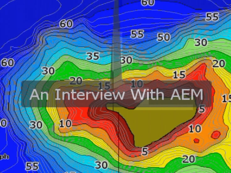
With that being said, I was very intrigued with how AEM became the organization it is today and how maps are made. So I’ll hand it over to Craig to tell his story of starting and running the company.
The Beginnings
A long time ago when I was growing up I fished a ton on the Nopiming, the Whiteshell and Lake of the Woods. I lived in Pinawa on the Winnipeg River. You couldn’t really get proper maps on a fish-finder to begin with. When you could get them on the fish finder, they were not accurate. To be honest, they were downright dangerous on the Winnipeg River. Reefs sometimes don’t exist even though they show up on the maps. Other times when they [reefs] exist, they don’t show up on the map. At times I daresay that it would be worse to have the map than nothing at all. You get complacent and you can get yourself into trouble if you rely on the map. For a long time, I realized that there needs to be better maps.

(PC: Angler’s Edge Mapping’s Facebook Page)
I’m a fisheries biologist so I learned a lot in school about GIS (Geographic Information System) technology and the creation of contour maps. Sonar technology was evolving pretty rapidly and Lowrance developed the technology to log data. I started to put the little pieces together. I started logging data to get a feel for it and before too long I realized I can not only log data, I can deal with this data and make something out of it that is usable. I started surveying complete lakes. My brother Rob, who’s now the Vice President of Angler’s Edge Mapping, and my dad helped out with the surveying. We were burning lots of gas and wrecking stuff. The costs started to add up.
Getting Into the Stores
Word was getting out amongst friends that we had these maps and we were putting them on the wall. We realized that we had to recover some of our costs so we started selling these print maps. We sold a few but we weren’t really trying to sell anything. At the time, we mostly wanted maps for our own purposes.
We made our agreement with Lowrance after they released tools to allow small companies to make digital maps for them. We released our first digital maps in 2015. We thought we might sell half a dozen chips in the first few months. Our catalogue wasn’t huge at the time. Literally days after we made this announcement, Brett Kalid from Pro Am Tackle, reached out to us to retail them. It blew our mind that our maps would be retailed. We thought it would be years down the road and it happened within days. It didn’t take long after that for The Fishin Hole to come onboard. I think Cabela’s joined within a year. Overall lots of enthusiasm from the retailers.

(PC: Angler’s Edge Mapping Facebook Page)
Print Maps and the Mobile App
Initially we would mount maps in poster type frames that you could get from an art store. I still have a few of those in my basement. We learned that people really liked the print maps, especially cottagers. However they weren’t terribly impressed with the quality of the framing. We hooked up with local company called Instaframe. They do high end custom mounting of pictures and artwork. They took things to the next level. We have plaque mounts that are mounted on 3/8” MDF boards. We also have float mounts which is more expensive than the plaque mounts but they look amazing as they push the map off the wall you get more of the visual depth.

(PC: Angler’s Edge Mapping Facebook Page)
A lot of customers were asking for maps to be available on an app. For a small company, it’s difficult to build an app. We specced it out. At best you would be looking at $100,000 to develop a map based app. So we partnered with Avenza Avenza who has done a really good job of putting our maps on their app.

The Art of Surveying
The way we do it there are no shortcuts. You have to spend a lot of time on the water. The amount of time spent on the water varies depending on the amount of habitat. If you want to make a map of a small prairie lake you don’t really have to be tight with your transects because there’s not a lot of structure. On the Canadian shield, it’s a totally different ball game. There could be structure anywhere so you really have to keep your transects tight. We survey adaptively so we have to tighten up our transects near features to describe them as accurately as possible. Sometimes we do a survey and we think we’re done. You get home, process the data and realize that you missed something and you have to go back. That adds to the cost. We’re based out of Winnipeg so it might be an hour, two hours or three hours depending on where you’re going.

(PC: Angler’s Edge Mapping Instagram)
Lake Winnipeg per unit area isn’t really a time cruncher as there isn’t really hittable structure and its mostly gradual slopes. You have to put in a lot of effort near the shore. Off shore you can be a little wider though you could potentially miss stuff. Per unit area it definitely takes a lot less time than Lake of the Woods, Shoal Lake or the Winnipeg River. The Winnipeg River is essentially solid structure, there is no real basin to speak of anywhere. To capture the detail well you have to put in the time.
You hit a lot of rocks and stuff, especially on the Shield. You got to be prepared for that but we’re getting better. There’s an art to surveying. Once you learn how to anticipate what you’re seeing on the sonar, you learn when you’re likely to hit stuff. We definitely went through fewer props, skegs and lower units compared five years ago even though we’re surveying more.
Life of a Surveryor
A typical day starts out pretty nice. The wind is calm at first. As soon as people get on the water, especially when fishing season starts you have to dodge boats. The wind will pick up throughout the day. It’s becomes a lot of work quick. I struggle doing multiple days in a row because you’re glued to the sonar screen looking for evidence of structure. It’s difficult on your head to focus that hard for 8-10 hours in a row. Though maybe it’s because I’m getting old because it used to feel easier.
A lot of funny stories relate to cottagers not understanding what we were doing. Some people thought we were staking out their cottages and one even threatened to call the cops. We have met other people that thought something was seriously wrong for us to be driving around aimlessly. They come out with great intentions to check on us and we have to explain what we’re doing. Some of them get it but some still think we’re crazy.
Everyone who surveys for us has harrowing experiences related to smacking rocks. I have a lot of history on the Winnipeg River. Sturgeon Falls is a spot that really scares me because I know the power of the river. I’ve rescued people who’ve swamped boats there. One of the neat times I remember involves surveying through Sturgeon Falls. We waited until the water was super low so it wasn’t terribly dangerous. We made passes from upstream and to downstream, there must have been 50 passes to get that all surveyed. For the most part, there was no real risk with the flow conditions but change the conditions and that’s a devastating piece of water there.

Special Thanks
My dad passed away last fall but he gave my brother and I the love for being on the water. We loved exploring and where we’re from, exploring is hard on boats. We wrecked his props and his motor numerous times. He was supportive the whole way. He paid for the repairs and insurance. When we started making a business on it, he put days on the water surveying for us. He didn’t want anything to do with the revenue that came out of the business. He was definitely the person we owe the most to and it was tough for him to be gone.
We really owe our pro-staffers a big thanks. Mike Borse has been with us from the very beginning. I knew him through fishing forums 20 years ago. I reached out to him when we launched the digital chips. He took a chance on us as he didn’t know who we were about at all initially though he liked the product. Derek Stannard has not been with us as long but he wins tournaments. We asked him to be on board because he gave us so much promotion from dominating bass tournaments in Manitoba. Matt Cornell’s resume speaks for himself as he’s probably one of the top guides in Manitoba. He was one of the first ones to buy a chip from Pro Am. He really found the value in it and he helped us in the growth of the business. When Matt says something, other people listen.

(PC: Angler’s Edge Mapping Facebook page)
We also have to thank our survey team. They have put in long hours in bad conditions. At times, they’ve given up plans to make surveys happen. It’s definitely not a glory job by any stretch.
Final Words
Huge thanks to Craig for taking his time to share his experiences with us on Fishing Prairie and Shield. The amount of work put in by the AEM team is quite impressive. It was quite an eye-opener to understand some of the behind-the-scenes of the operation and how their product became a part of the fishing arsenal of many Manitobans.
For more information check out their website. For updates on the latest developments check out their Facebook and Instagram pages.


